


Sable Island is a narrow sandbar stretching about 44 kilometers, located roughly 300 kilometers east-southeast of Halifax, Nova Scotia. Today it is best known for its population of wild horses, but in the past it inspired fear among mariners. Often concealed by heavy fog, powerful storms, and shifting waves, the island earned the reputation as the “Graveyard of the Atlantic,” where countless vessels met a tragic end. Since 1583, more than 350 shipwrecks have been documented along its shores. Time and the moving sands have erased most physical traces of these disasters, leaving behind only scattered remnants such as shoe buckles, coins, fragments of name boards, and pieces of timber buried beneath the dunes.
Sable Island Shipwreck
In mid-May 2025, archaeologists from Parks Canada uncovered part of a shipwreck that had been buried in sand at the base of a tall dune on Sable Island. As excavation progressed, sand continuously slid down the dune face into the site, requiring the use of sandbags to stabilize the slope. Even though the wreck was located above the waterline and remained mostly dry, the team included underwater archaeologists due to their specialized knowledge of shipwrecks and maritime history. The team documented the site through precise measurements, photographs, and sample collection. Once this work was completed, the wreck was carefully reburied to protect it from wind erosion and flooding, preserving it until further investigation can take place.
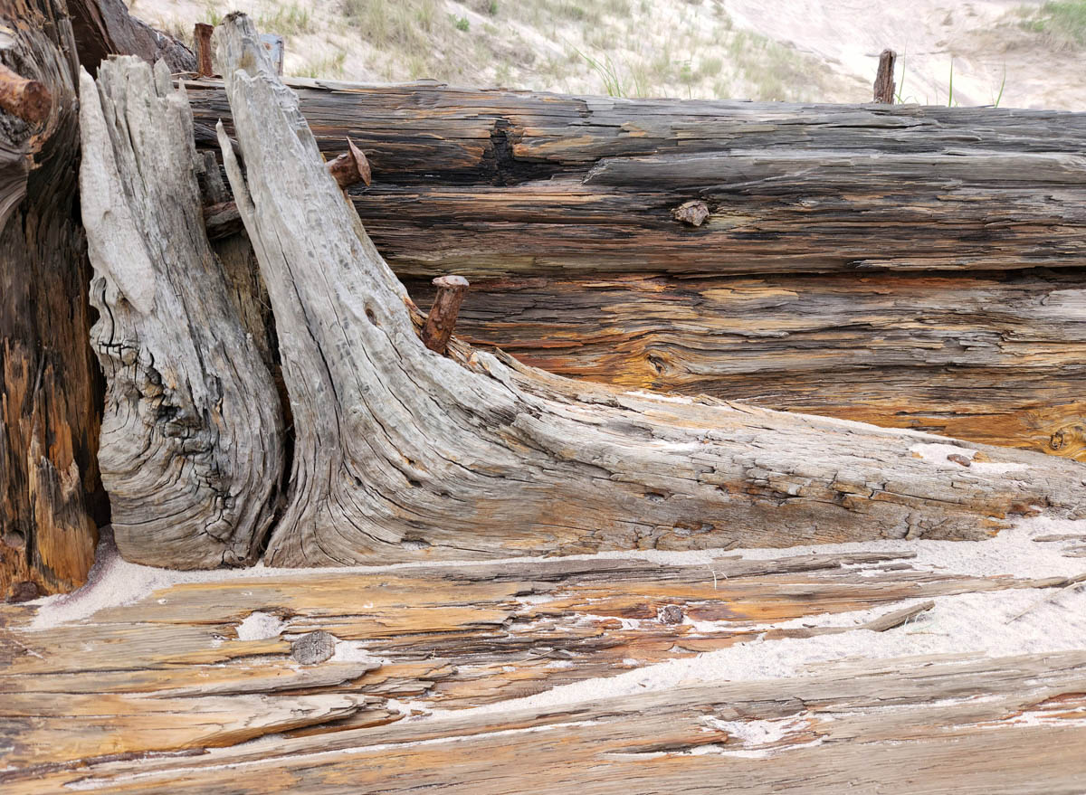
The wreckage lies along Sable Island’s south beach at the foot of a steep dune. For many years it was largely hidden beneath sand, but ongoing wind erosion and shifting dunes have uncovered sections of timber and iron. Among the exposed remains are several ship’s knees. Although one example is cracked and damaged, its characteristic curved form is still recognizable. Ship’s knees were specially shaped wooden supports used in traditional wooden vessels to strengthen the structure, often bracing deck beams to the hull. Many were crafted from naturally curved sections of trees, particularly from roots or bent trunks, which provided the strength and angle needed for ship construction.
Why Were There So Many Shipwrecks?
Several factors made Sable Island especially dangerous for ships. Its location placed it close to one of the world’s most productive fishing areas and along a major transatlantic shipping corridor between Europe and North America. As a result, hundreds of vessels passed nearby each year, increasing the chances of disaster.
The island is also situated directly in the path of many storms that move up the Atlantic coast of North America. These powerful systems were particularly hazardous for sailing ships, which could be driven helplessly onto the island’s shores by strong winds and rough seas.
Fog added another serious threat. During the summer months, warm air from the Gulf Stream meets the cold air influenced by the Labrador Current, creating thick fog banks around Sable Island. The island experiences fog on about 125 days each year, compared to roughly 35 days in Toronto, greatly reducing visibility for navigators.
Compounding these dangers are the complex ocean currents surrounding the island. Sable lies near the meeting point of three major currents—the Gulf Stream, the Labrador Current, and the Belle Isle Current—making navigation unpredictable and increasing the likelihood of ships being pushed off course.
THE SCUBA NEWS Link !
DemirHindiSG 17 Aralık 2025-17:27